
The Needle Points North
We have been like hunters who have lost the points of the heavens and from whom the sun has been held for days,’ said Hawk-eye, turning away from his companions. The Last of the Mohicans. J. Fenimore Cooper.
Had Hawk-eye been able to obtain a compass he would have rated it second only in value to his famous rifle “kill-deer.” In the Leather Stocking Tales, Cooper’s scouts are represented as telling directions, when the sun was obscured, by observing on which side of a tree of the forest the moss grew thickest. As a youngster playing at scouting I made many attempts to put this little gem of scouting lore into practice without any success, and have long since learned to depend on the magnetic compass for direction. The sun is a dependable guide, but there is no assurance that it will be visable when the need to determine a proper course is an immediate necessity.
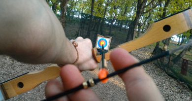
A simple incident proved to me the value of a pocket compass. With a companion, I was hunting birds on a day in late November over terrain which was relatively flat, and made up of abandoned farm lands owned by a mining company. The day was overcast but the sun was visable through the haze. We were hunting over land with which we were well acquainted and knew the general direction to hunt in order to return to a summer camp where we had parked our car. About three in the afternoon the wind increased in force, and suddenly it began to snow. As the snow flakes increased in numbers, it became increasingly difficult to see for any distance. We had enjoyed a good day and the biting wind was rapidly making us feel uncomfortable. We started to return to the car, and in the interval of time that it took to walk about 1oo yards, large flakes of snow blown almost horizontally across our front completely obliterated the familiar landscape and confined our field of vision, at most, to a few rods. While not unduly alarmed, the prospect of spending any considerable time, under such conditions, in the open was not pleasant to contemplate. Even the two setters were satisfied to remain at heel and did not have to be admonished at intervals to remain there.
The wind tore at our clothing in sudden gusts and we appeared to be walking first in one direction and then a moment later on another, as the wind veered from one point to another. A query from my hunting companion, who asked, “Do you know the way to the car?” resulted in an abrupt stop for consultation. We were agreed on the general direction which we should travel to reach the car. and my pocket compass was quickly consulted to determine that direction. As we were unable to take a bearing on a distant object and walk toward it, I held the compass fixed so that the needle coincided with the North point of the card. Keeping my body and the compass in the same relative position, I turned slowly around until the North end of the needle pointed to the desired bearing. Thus in a manner exactly similar to the method a helmsman uses to steer a vessel by the magnetic compass, we walked through the blinding snow storm. In a short time the land began to dip away from us as we entered a small draw, which led to a spring we recognized as the source of the water supply for the summer house. Chilled fingers quickly pocketed the compass as we knew we were within thirty yards, more or less, of the house, which was quickly located. Had we actually been in any danger? Well, the storm kept up until dusk and I assure you that without the compass and a fair amount of know-how regarding its use, we might have suffered severely from the cold before we located a road that would have brought us eventually to the shelter of some farm house.
To make use of the magnetic compass it is essential to understand the principal on which it works and the degree of accuracy that can be obtained in determining a true bearing by its use. The lines of force of the earth’s magnetic field are employed to direct a needle mounted on a pivot so that it only moves freely in a horizontal plane, and therefore the horizontal component of the earth’s force alone directs it. The direction assumed by the needle is not generally toward the geographic North but,
Apart from local disturbances (such as those due to iron in the soil, or in mines, trap rock, articles made of iron or steel and carried on or about the person, steel in structures, etc., which cause the needle to be deflected from the magnetic meridian by a horizontal angle called the “deviation” of the compass) the declination varies from place to place at a given time, and from time to time at a given place. However, in the United States there is an “agonic line” or line of no declination marked on the chart as O degrees, entering the country at present in the State of Michigan and leaving it in South Carolina. Along this line, the needle normally points approximately true north and south; but, at points not on or near the agonic line, the north end of the needle tends toward the line. In other words, at points east of the agonic line the declination is west, and vice versa; and this declination increases with the distance of the point from the agonic line, reaching at present 23 degrees west in Maine and 24 degrees east in the State of Washington.
Therefore, our first problem is to determine the magnetic declination in the locality in which the compass is to be used. On each quadrangle sheet of the United States Geological Survey topographic maps the magnetic declination or magnetic North, corresponding to the year of the survey for the area, is depicted on the margin of the sheet, The standard compass card is divided into 32 points and each of the four quarters or quadrants is divided also into 90 degrees. A satisfactory pocket compass is about the size of a watch and should be enclosed in a Hunter case to protect the glass crystal. A mechanical means to hold the needle off the pivot when the compass is not in use is highly desirable. This prevents excessive wear of the pivot. A number of these devices operate automatically when the metal case is closed. This is a desirable feature. Eight of the cardinal points of the compass, to wit: N, NE, E, SE, S, SW, W, and NW, are all that are necessary for the pocket variety of compass. An outer circle subdivided into four quadrants, each containing ninety degrees, completes the pocket compass card. Compass directions are expressed either as “bearings” or “azimuths,” or by naming one of the cardinal points. Bearings are measured in each quadrant of the compass from o° to oo°. Azimuths are measured in a clock-wise direction from o° (North point, generally embellished with a fleur-de-lis) to 3600. Typical directions are shown in
Suppose our destination is geographically N 40 ° W of our present location. How will the compass appear to us so that we can travel in the required direction and reach our destination? The required compass setting is shown in
The foregoing statements are true also for South and the south end of the needle).
The question immediately arises in the reader’s mind: How is the direction of travel ascertained by use of the magnetic compass? There are two common methods which may be employed. The first method described hereafter is probably the simpler method. Hold the compass in the hand and revolve the box slowly until the north point on the card is directly under the north end of the needle. In the northern hemisphere, the north end of the needle dips toward the earth; and to bring the needle to a horizontal position, a bit of fine wire is wrapped around the southern portion of the needle. Thus the north end of the needle is readily identified. The needle will now be in the position indicated by the letters N and S in a
Now project an imaginary directional line of sight from the center of the compass needle through the 400 mark located on the arc of the compass card between the north point and the letter W. This sight is represented by the heavy black line in the drawing, and it is pointing out from the center of the compass on the magnetic bearing N 400 W. However, our destination is N 400 W of the geographic or true North and we must compensate for the decimation of the needle in our portion of the
United States. Suppose we use the declination in North Central Pennsylvania, which is 70, and for reasons previously explained we know that the compass needle is pointing 70 west of true North. Therefore, we rotate the compass clockwise until the north point of the compass card is 7° to the observer’s right or east of the north end of the compass needle.
The second method: North on your topographic map is at the top of the sheet, and as you look at the map, East is to your own right and West your own left, while South is at the bottom of the sheet. Locate true North with your compass and lay the map flat with the top pointing toward the North (Geographic or true North). This is called “orienting,” a map, Figure 49. Your present location is designated on the map by point marked a and you wish to travel to point marked b. Draw a straight line through these two points on the map with a soft pencil, and lay your compass on the map so that the center of the needle is directly over point a, which marks your present position, and the north point of the compass card is 70 east of the north end of the needle,
Therefore your correct compass reading for the course (a-b) is 40° minus 70, which is N 330 W, which in turn is exactly the same reading shown in
Since the compass will not register accurately if near your gun or axe, or any other iron or steel that may be on or near your person, and you are in doubt about a direction, move a short distance and make a check reading. If you are convinced that North is in some other direction than that indicated by your compass, I suggest that you defer to the compass north. After all, you could be wrong and probably are. No one will know you lost an argument to your compass and it will bring you safely back to camp.